
THE PROCESS
The first thing I did at the beginning of my mapping journey was set up an account. This proved to be slightly tedious as all variations of my full name were already in use (apparently). Once I was finally able to set up my account, I then went to the tutorial. For whatever reason, many of the text boxes were cut out, and I could not read the full explanation. I decided it would be better to use my time to practice mapping in my local area instead. I marked out little details about the area that I knew as a resident of my neighbourhood, including the location of an old graveyard. I found the tools easy to understand. They were straightforward for me to get a grasp of all things considered. This made using the tools much more enjoyable for me. After my practice round, I went into the Cork section of the map. I was able to find some squares that hadn’t been previously mapped and set to work. It was around the fourth square when I had realised that I had forgotten to take pictures. I took a few photos of the fourth square and took some of my final square, which I did in Kerry for a change of scenery.
THE IMPLICATIONS
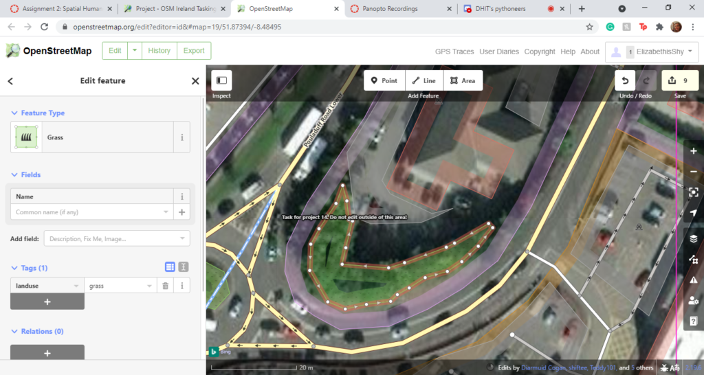
Within the Cork sector, there was a lot to map. It was primarily houses, roads, driveways, industrial building, residential areas, car parks and other buildings I noticed. Often I had to zoom into the section on the map I was doing very close; it was often hard to tell where one house stopped and another began. If I had to make an estimate, I would say that I mapped something close to 200 homes in total for the squares I did in Cork. It was sometimes difficult to see where the fronts of these houses were as other objects slightly obstructed the view on the map, i.e. Trees. There weren’t many grass areas in the area as it was all mainly developed, so these sections were straightforward for me to mark. It was also easy for me to mark out the general areas of car parks as they usually contained lots of cars or had visible white lines to mark them. I kept many building as just buildings as I was unsure as to what their purpose could have been. Sometimes, there were sections of my square that I didn’t know what to make of at all. This was a result of the images not being completely perfect, especially when zoomed in. I occasionally found the uploading of my work a bit tedious as sometimes I would accidentally not fully connect a driveway to the road, or I might accidentally overlap two houses together. This slowed my pace a good bit as I would have to fix these mistakes before the site would allow me to proceed. I would also often take at least 40-60 tasks before I remembered to save my work as there was so much to mark I would get lost in what I was doing. The sheer amount of mapping was befuddling. I found that listening to podcasts throughout the process helped to keep me from losing my mind.
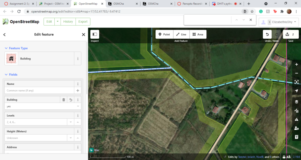
The Kerry sector was a slightly different story. I had chosen to map an area in the countryside, which meant I was mostly marking farmland. It took me a considerably shorter amount of time to map the region as it was much simpler to look at visually speaking. This meant that I had far less focus on, which made things a lot easier for me. There were about seven or so houses and a few farm buildings as the square at most. As previously stated, the rest of what I had been mapping was mostly farmland except for a few minor roads. I appreciated the easiness of mapping the Kerry countryside in comparison to the Cork sections. I did, though I did get lost a bit in the work I did on this section. It wasn’t so much that there was so much to do that I got fixated on multiple little details but more that it was so relaxing by comparison.
WHAT I LEARNED
I have learned from this experience the amount of work that goes into mapping for websites, e.g. Google Maps. I never really thought about the sheer amount of work involved in making these electronic maps before doing this. At times judging if something was used as a house, a shop or something entirely difficult was a challenge. It was also hard to see where some roads began, and others ended. Attempting to answer these questions myself made me appreciate the long hours involved in mapping. It also made me think about how much time it must take individuals to tell their software what is a building and what is a patch of dirt. I also learned about mapping communities as a whole, thanks to this experience. Before undertaking this assignment, I never imagined that there could be groups of people who did this sort of thing, especially not for fun. It was fascinating to interact with these people through these sites and learn about the various projects. While it is not a hobby I would take on; I can understand why some people would find it fun. There is something satisfying about being a modern-day Anaximander (a Greek geographer and scientist who was said to have made the world’s first map sometime around the sixth century).
HOW MIGHT I USE THIS SOFTWARE IN THE FUTURE?
At first, I was unsure about how I might use what I learned using MapSwipe and OpenStreetMap in the future in both my personal life or future work. I mean, what use do most ordinary people have for these crowdsourced initiatives? It’s a bit of a difficult question to answer. On the one hand, I suppose it gave me a better sense of Ireland geography-wise. Then again, I’m someone who suffers from dyspraxia, so spatial awareness is something of a challenge regardless of my knowledge of an area. Then I thought about all the little details that went into these maps, and I realised something sort of insane. Using the skills I’ve gained from mapping these areas, I could help out more in my neighbourhood events. Every year within my housing estate, we have Easter egg hunts. A consistent complaint I hear year after year is that the maps are never clear enough. They fail to show different landmarks that help navigate the children as to where they should be looking for their eggs. So when the time comes for the Easter egg hunt next year, I can take the same tools from OpenStreetMap and use them in our maps.
Another thing I realised that I could try to do with these new skills is fictional map places. This is very important to me as someone who writes a lot of short stories in made-up areas. If I were to ever go about trying to publish these stories, I would be able to have some notion of what it is I am talking about to other people. There is also the added bonus of being able to improve my world-building as a whole. The possibilities are endless.